Colonial and Early Independence Horizons
Until the 1960s, church spires, civic domes and low-rise shophouses dominated photographs from the Singapore River. The Padang axis established a formal relationship between British municipal buildings and the harbour that planners later extended southward.
Early independence-era housing and industrial zones grew inland; the waterfront remained the ceremonial face presented to visiting dignitaries and shipping lines.
Raffles Place and the First High-Rise Cluster
Financial liberalisation and limited land drove vertical growth in the central business district. Towers from the 1970s through 1990s — OCBC Centre, UOB Plaza, Republic Plaza — competed for height records while respecting setback and wind rules emerging from the Urban Redevelopment Authority.
Podium-and-tower typologies preserved street-scale retail while concentrating office floor plates above, a pattern Marina Bay later adapted at larger parcel scale.
Marina Bay as Deliberate Skyline Theatre
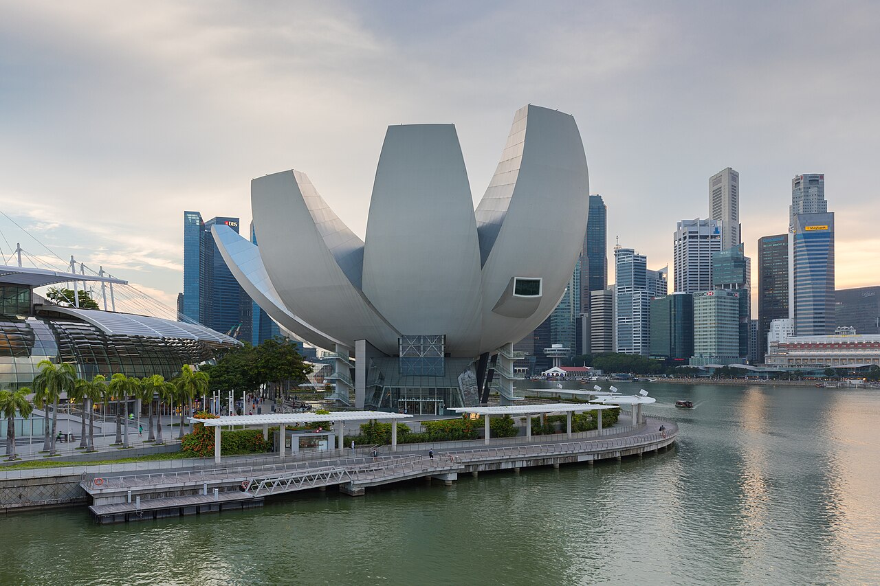
Reclamation did not merely add land; it created a stage. The Esplanade's spiky glass shells, the durian-like profile, entered the skyline in 2002 as a cultural counterpoint to orthogonal office blocks.
Marina Bay Sands then introduced a horizontal landmark — a deliberate contrast to vertical thrust. Gardens by the Bay's Supertrees and cooled conservatories added biophilic vertical accents along the eastern margin.
URA height controls preserve selected sightlines from the Padang and civic district toward the bay, preventing ad-hoc wall effects along the waterfront.
Iconography and Global Recognition
Tourism campaigns and film placements reinforced Marina Bay as Singapore's postcard image. Architectural icons function as wayfinding devices: visitors orient from MRT stations using SkyPark and Supertree silhouettes.
Critical discourse asks whether icon-driven planning overshadows everyday public housing and industrial architecture — a debate urban scholars document in Southeast Asian city studies.
Nighttime Legibility
Façade lighting programmes on SkyPark, Helix Bridge and ArtScience Museum extend skyline reading after dark, supporting evening economy activity along the bay.
Future Additions and Retrofit
New office towers on remaining parcels will rise under stricter sustainability codes — higher glazing performance, integrated photovoltaics and elevated public floors. Retrofit of older CBD buildings proceeds in parallel, producing a palimpsest of construction eras within a single panorama.
- 1970s–1990s: CBD vertical cluster formation
- 2002: Esplanade cultural landmark
- 2010: Marina Bay Sands integrated resort
- 2012: Gardens by the Bay public gardens
- Ongoing: sustainability-driven tower retrofits